FoodScapes Atlas
Spatially-referenced stories of food in the Tyne-Tees seascape
17 October 2024
Professor Maggie Roe and Dr Maria Duggan have launched the ‘FoodScapes Atlas’, a digital, shareable, atlas with spatially-referenced stories of food in the Tyne-Tees seascape. This is an output of the FoodScape Project, part of the SeaScapes Landscape Partnership Project (Tyne to Tees, Shore and Seas). The FoodScapes Atlas - which comprises a Google Earth map with slideshow - can be accessed via the link below.
The Foodscapes Atlas reveals the ways in which people and communities interact with the rich resources of the seascape over time, through gathering, harvesting, preparing, cooking and eating food. It leads users on a ‘virtual journey’ through mapped locations along the Tyne-Tees coast, presented in ten thematic slideshows, and introduce them to unique food stories and images from the region, as well as food-based connections with areas far beyond. The food stories are based around evidence from research and investigation of archival material, documents, images, interviews, discussions and engagement projects. The focus is on how people have exploited, developed and interacted with the resources of the seascape, and how the Tyne-Tees landscape character has evolved and changed, along with its smells, sounds, sights, feel and flavours. The Atlas presents a complex and rich picture of both everyday and special foods, places that are connected to food, and the fascinating histories of sharing and enjoying food in this region.
SeaScapes is a landscape partnership project and is the first to be focused on the coast. The area covered is between the Tyne to the Tees rivers. The project has a wide range of partners including the four councils of Durham County Council, Hartlepool Borough Council, South Tyneside Council, Sunderland City Council with a range of archaeological, environmental and charitable partners including the National Trust and the Durham Wildlife Trust. There are almost 20 partners and these bring their expertise and knowledge to the project. The project is almost £5million made up of a grant of £2,787,200 from the National Lottery Heritage Fund and match funding from partners.
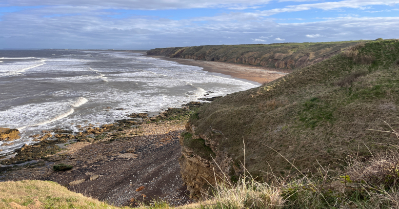
Atlas Image: Blackhall Rocks. Image: Maria Duggan and Maggie Roe
If you would like further information on the FoodScapes Atlas, or would like to tell us how you are using this resource, please get in touch with maria.duggan@ncl.ac.uk