

Coquet historical flooding
How the changing course of the Coquet could prevent flooding
Published on: 27 January 2020
A 3-D model of how a Northumberland river has changed course over the past 150 years is helping scientists better understand the risk of it flooding in the future.
Comprehensive model
Researchers at Newcastle University used a large amount of data including historical maps, aerial images and surveys of the ground both above and below the surface to identify where and how the river Coquet has changed course since 1860.
It is thought to be the first ever study of a UK river that brings together such a wide range of information over such a long period of time and will provide a new comprehensive model of the evolution of gravel-bed rivers in the UK.
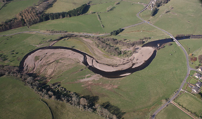
The work has been carried out by Safaa Al Zerouni, a PhD student at Newcastle University. Looking in detail along a 17 mile stretch of the Coquet between Alwinton and Rothbury, Safaa plotted key changes over the years and produced maps showing details of gravel bars, vegetation, channel boundaries and changes in the sediments alongside the river. By comparing the changes, she identified how much influence these factors have had on the course of the river throughout the past 150 years.
Dynamic river
This section of the Coquet was badly flooded in 2008, when the river reached its highest level ever recorded. Although some of the analysis is still ongoing, Safaa’s research has indicated that the river was significantly altered by these floods and has not recovered its pre-2008 flow pattern.
Safaa explained: “The Coquet is a very active, dynamic river and has changed course many times throughout the last few hundred years. As the river meanders, sediment builds up along the sides and bottom of the river, affecting the speed the river flows at. If there’s enough sediment, this can be enough to force the river to change course.
“Often these are very subtle alterations that are only apparent when you compare pictures taken a few years apart or look at changes in sediments below the surface. But some changes are very obvious - the floods in 2008 significantly altered the speed and direction of the Coquet, and the impact of these changes on the shape of the river can still be seen.
“By understanding the relationship between the river and the land we can better anticipate where it might flood in the future, helping those living alongside or managing land next to the river prepare for when that happens.”
Detailed study
Professor Andy Russell, Professor of Physical Geography, Newcastle University said: “Safaa’s detailed study reveals that the River Coquet is one of the UK’s most dynamic rivers in terms of how rapidly it changes its course across the flood plain. Unlike many rivers, the Coquet is fully connected to its flood plain allowing more natural interplay of water, sediment and vegetation. This interplay is vital in helping to ‘slow the flow’ and thereby reduce downstream flood levels and associated risk.”
Safaa’s PhD builds on research that she carried out as part of her Masters degree looking at the immediate impact of river flooding and the factors influencing recovery rates, focussing on the river Coquet at Sharperton and Holystone.


